The Pilgrim Route from the San Bernardo Pass to Rome.
The Via Francigena is the name given to the pilgrim route from Canterbury to Rome. In medieval times it was an important pilgrimage route for those wishing to visit the Holy See and the tombs of the apostles St Peter and St Paul.
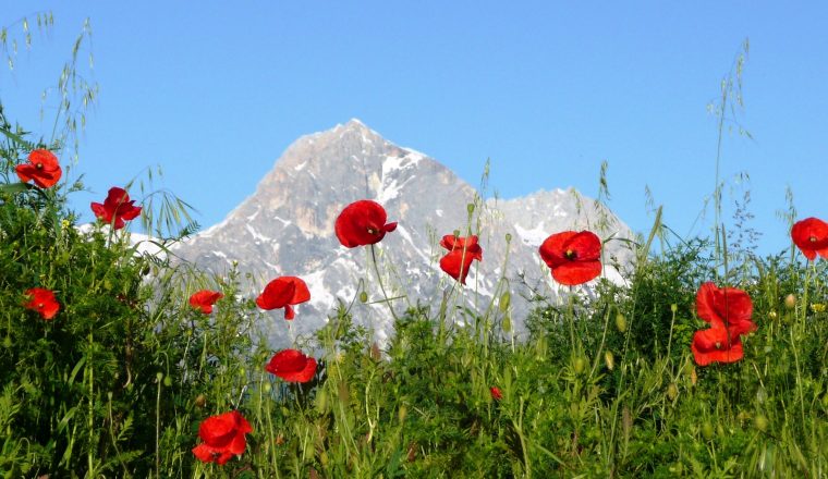
The Italian part of this route starts in the village of Bourg St Pierre n the Swiss-Italian border. From here walk the high mountain pass of St Bernard down to the Apennine mountains to the gorgeous Tuscan landscape as you make your walk down to Rome. Because the first day’s walk takes place in the Alps, this part of the route can only be safely walked from June as it is likely to be snowbound up until then. This of course means that you then arrive into Tuscany and the warmer parts of Italy in high summer so July or August are perhaps a better time to start the walk.
The full route from Bourg St Pierre to Rome takes 50 days/49 nights. The route can be done in separate shorter sections that are outlined separately on our website. Rest days can be added along the route – just ask and we will do our best to accommodate your wishes.
This is the entire Italian section of the Via Francigena, the Pilgrim Route from the St.Bernardo Pass to Rome.
Price:
£4,715 per person based on 2 people sharing – without luggage transfers
£5,425 per person based on 2 people sharing- with luggage transfers
Single room supplement £985
£7,475 Solo walker with luggage transfers / £6,125 Solo walker without luggage transfers
We can book dinner on 5 nights per week – cost £130
Included:
Not Included:
Departures:
The route starts in the Alps – the first week of this route is not possible before June. Sometimes people start a couple of days into the route and then return at the end to do the first couple of days.
Getting to Bourg St. Pierre: Nearest airport (160 kms) – Geneva.
Nearest train station – Orsieres (14 km from Bourg St Pierre). Bus takes 30 minutes. Time tables at www.sbb.ch/fr/.
Departure from Rome: Nearest Airport – Rome Fiumicino or Ciampino
Nearest train station – Roma Termini
Day 1: Bourg Saint Pierre
The starting point of the tour is Bourg-St-Pierre, a Swiss village that is at the door of Italy and rich in history as the ancient buildings, restored mill and numerous traces of the passage of the travellers testify. History and legend join in this place where it is easy to imagine the troops of the Roman Empire and later the troops of Napoleon that passed from the Colle del San Bernardo.
Altitude at departure: 1632 m above sea level
Day 2: Bourg Saint Pierre to Colle Del San Bernardo
This stage has a mainly symbolic nature as it will lead you to the Colle del San Bernardo, the highest point between Canterbury and Rome therefore of the whole Via Francigena. Mule tracks and paths bring you to the famous Hospice on the Colle del Gran San Bernardo where San Bernardo di Mentone laid, more than 1000 years ago, the first stone.
Altitude at arrival: 2473 m above sea level – 11.50 km – 5h
Day 3: Colle Del San Bernardo to Etroubles
Today’s stage begins among the amazing mountain scenery of the Colle del Gran San Bernardo, and runs almost completely on a path that crosses St. Rhémy en Bosses, where the valuable raw ham of Bosses is produced, before arriving, between fields and woods, at the village of Etroubles, the former capital of the Gran S. Bernardo Valley in ancient times. It was the winter residence of the border garrison and is where Napoleon stopped during his descent into Italy.
Altitude at arrival: 1270 m above sea level – 13 km – 4h
Day 4: Etroubles to Aosta
The leitmotif of this stage are the ‘Rus’, water canals that decisively contributed to the development of agriculture in these areas. Walk along these canals before the steep descent towards the city of Aosta, which has many legacies of its Roman past the Porta Praetoria, the Theatre and some stretches of the walls. The medieval cathedral rise on the remains of a IV century Domus Ecclesiae.
Altitude at at arrival: 580 m above sea level – 16 km – 4h30
Day 5: Aosta to Chambave
From Aosta the itinerary continues up the Valley, between wine groves and castles, across the Chemins de Vignobles. Following an irrigation canal you arrive at the XII century Castel’ Quart and then Castel’ Nus, while in the valley bottom you can see the Castel’ Fénis, residence of the Challant family. Arrive for overnight at Chambave, a little town of the Mountain Community of Monte Cervino. Notable are the Church of San Lorenzo with Romanesque bell tower and all around the renowned Muscat wine groves.
Altitude at the arrival: 470 m above sea level – 27.50 km – 7h30
Day 6: Chambave to Verres
Walking along a panoramic path you pass over the basins of Chatillon and Saint-Vincent to reach Verrès, located on the banks of the Evançon. The Castel’ Verrès is an example of gothic fortress, cubic in shape and with walls two metres thick, reachable only on foot and along a mule track.
Altitude at arrival: 370 m above sea level – 27 km – 7h15
Day 7: Verres to Pont Saint Martin
This last stage is rich in fascinating items: the XI century Benedictine Church of San Martino at Arnad; the splendid XVIII century bridge of Echallod and the medieval bridge and the huge Fortress of Bard. Finally, the Strada delle Gallie (street of Gauls), with much of its original paving, and the Roman bridge of Pont St. Martin.
Altitude at arrival: 345 m above sea level – 20 km – 6h30
Day 8: Pont Saint Martin to Ivrea
Crossing the Canavese brings you into Piedmont, winding among countryside areas, hamlets and woods. From the hills located north of Ivrea, you will see distant Montalto castle, a huge fortress with high towers dating back to 1300. Arrive in Ivrea, located on the banks of the river Dora Baltea, in an area which is rich in environmental and geological features, and surrounded by five glacial lakes.You may visit Conte Verde’s Castle located in the city’s historical centre, close to the Cathedral and the Bishop’s Palace. San Bernardino’s church has ancient origins and houses a precious collection of frescos representing the life of Christ, painted by Martino Spanzotti.
Height at arrival: 253 m a.s.l. – 26.5 km – 7h
Day 9: Ivrea to Viverone
The first part of the today’s stage wanders through the countryside and then across hills with good views over the valley. Continue to Lake Viverone, with crystalline water and rich in uncontaminated plant and wild life. Nearby is the village of Piverone, with an interesting Bell Tower. This village was founded in 1200 and was completely fortified with walls and defensive towers.
Height at arrival: 287 m a.s.l – 22.7 km – 6h
Day 10: Viverone to Santhia
After a quiet walk beside Lake Viverone, continue through woodland to cross one of the last hills before reaching the plain. The first village you meet during the long passage across the Padana plain is Santhià, an agricultural centre where two branches of the Francigena Way join: one towards the Gran San Bernardo Pass and the other one towards the Susa Valley. Worth seeing here is the neoclassical public palace and the Church of S.Agata dating back to the X sec.
Height at arrival: 183 m a.s.l – 16.7 km – 5h
Day 11: Santhia to Vercelli
This is the first completely flat stage and it goes for the most part on country tracks in a landscape of fields and farm houses. Reach the city of Vercelli, strategic junction at the cross of two branches of the Francigena Way (Jacob toward Turin and Susa Valley, and Sigeric toward Valle d’Aosta) at the end of this stage – medieval Cavour square is almost surrounded by ancient houses and is overlooked by the medieval Angel Tower. The neoclassical Cathedral is imposing, but most important is the renowned Basilica of Saint Andrew, a masterpiece of the Romanesque-Gothic of North Italy.
Height at arrival: 130 m a.s.l – 30.5 km – 7h30
Day 12: Vercelli to Robbio
After a short walk in the countryside, continue along the banks of the river Sesia. The itinerary becomes wooded as you cross the border between Piedmont and Lombardy. Near Palestro, you will leave the river to reach Robbio, an important agricultural and industrial centre on the Pavese plain.
Height at arrival: 120 m a.s.l – 23 km – 6h
Day 13: Robbio to Garlasco
First you continue across the Pavese countryside to Mortara, battleground of the Franks and the Longobards of King Desiderio, and the home of Salame d’Oca (goose salami). From here we recommend you continue by train to Tromello to reduce the length of this long stage.Height at arrival: 93 m a.s.l – 36 km (less with train Mortara/Tromello)
Day 14: Garlasco to Pavia
Today’s stage is in two parts: the first one across the plain and the second along the banks of the Ticino, the river that connects the Lake Maggiore with the river Po. The area, the first regional park in Italy created in 1974, can be visited by foot, by bike, by horse or with a canoe and is an area of monasteries, abbeys, convents and basilicas. The stage ends in Pavia, one of the major halts on the Via Francigena. Much to see here – the Visconteo castle built in 1360; XII century San Pietro in Ciel d’Oro (mentioned in the Divine Comedy); the Cathedral; San Michele Maggiore, a Romanesque Basilica of the XI century; the famous Ponte Coperto (covered bridge) on the river Ticino and the Palazzo Bottigella.
Height at arrival : 77 m a.s.l. – 32 km – 7h30
Day 15: Pavia to Miradolo Terme
Today we follow the river Ticino, that shortly enters the river Po. The itinerary continues parallel to the main road to Cremona, but you may walk across the countryside in the surroundings of Pavia among fields and woods. At Belgioioso, there is Belgioioso Castle, a neo-classical residence built in the XIV century by Gian Galeazzo Visconti.
Height at arrival: 71 m a.s.l. – 27 km – 7h
Day 16: Miradolo Terme to Calendasco
The itinerary continues across fields close to the hills to Chignolo Po Castle, place of rest for pilgrims on the Francigena Way since the Middle Ages. The castle, built in 1200, is impressive as result of numerous refurbishments over the centuries. Finally, Lambrina, a village taking its name from the River Lambro.
Height at arrival: 60 m a.s.l. – 17.5 km – 4h
Day 17: Calendasco to Piacenza
Orio Litta is an interesting village that is worth a visit before reaching Corte Sant’Andrea, crossing point for the ferry across the river Po and docks in the same place where Sigerico passed 1000 years ago. If you do not want take the ferry or if the ferry is not available, the itinerary continues along the north bank of the river and arrives at Piacenza. In the centre of Piacenza is a big square, Piazza dei Cavalli, overlooked by the gothic Public Palace, dating back to 1281. Worth visiting is the Romanesque basilica of S. Antonio founded in the IV century, the Romanesque cathedral and the Romanesque Church of San Savino, consecrated in 1107, with wonderful mosaics representing the months of the year and the zodiac.
Height at arrival: 61 m a.s.l. – 15.5 km – 4h
Day 18: Piacenza to Carpaneto
To avoid the busy Via Emilia, the itinerary takes you across the relaxing landscape of the plain. Fiorenzuola was a Celtic and Etruscan settlement with much evidence of the numerous “hospitals” for the welcome and assistance to pilgrims on the Francigena Way.
Height at arrival: 80 m a.s.l. – 26.5 km – 6hr 30
Day 19: Carpaneto to Fidenza
Pleasant stage on secondary roads and tracks. You pass the wonderful Abbey of Chiaravalle, a Cistercian abbey founded in 1136, the main part of which is the basilica and the beautiful XIV cloister. The walking itinerary ends in Fidenza.
Height at arrival: 57 m a.s.l. – 34.53 km (can be reduced to 26.5 with transfer to Vigolo Marchese)
Day 20: Fidenza to Fornovo
This slightly hilly stage, among fields, vineyards and farms ends in Fornovo di Taro, an important junction of communication of Celtic origin that became a merchant and religious centre in the Roman era.
Altitude at arrival: 158 m above sea level – 31.7 km – 7h 30
Day 21: Fornovo to Cassio
Short transfer to Sivizzano from where you start the ascent to the Cisa Pass. This is a fairly strenuous day but there is much to enjoy – the landscape, and the charming parishes of Bardone and Terenzo. Finally, “I salti del Diavolo” (‘the leaps of the Devil’, outcrops of rocks dated 80 million years) lead to the characteristic village of Cassio. Arrival in Cassio, with its centre paved in local stone and its Church of Maria Assunta among its ancient houses.
Altitude at arrival: 818 m above sea level – 20.8 km – 5h
Day 22: Cassio to Berceto
Continue through the Apennines and at about halfway you walk through the little village of Castellonchio, ancient “borgo-strada” (village-street) where little houses were built one next to the other along the Via Francigena. The itinerary continues and ends in Berceto, a little town but important communications centre because it is situated on the Via Romea. The Romanesque Duomo is worth a visit and also the Sanctuary of Madonna delle Grazie in baroque style with neoclassic details.
Altitude at arrival: 808 m above sea level – 10.6 km – 3h
Day 23: Berceto to Montelungo
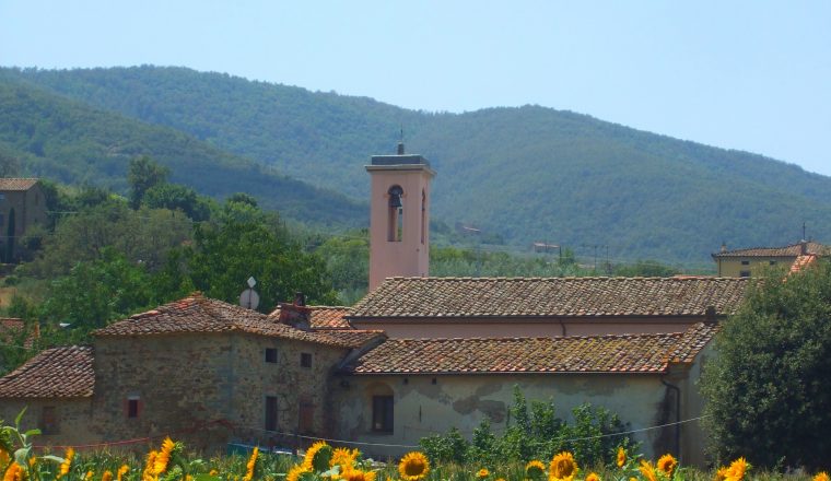
Today you leave Emilia Romagna to enter Tuscany. This part of the itinerary gives some of the most beautiful landscapes of the whole Via Francigena and at the top of Mount Valoria, the panorama ranges between the Taro and Magra Valleys. From the Cisa Pass you see Tuscany, down the steep slope covered in beech and chestnuts trees. Overnight in Montelungo.
Altitude at arrival: 821 m above sea level – 13.4 km – 4h30
Day 24: Montelungo to Pontremoli
From Montelungo you reach Cavezzana D’Antena. After the village of Groppoli the itinerary descends to the river Magra, which you cross over a stone bridge “a schiena d’asino” (humpback bridge) from 300 A.D. Walking on, you will note the crosses and carvings that mark the stations of the Via Crucis. After Arzeglio you reach Pontremoli, whose fortress from 1000 AD is the seat of the museum of the mysterious statue-stones.
Altitude at arrival: 244 m above sea level – 17 km – 6h
Day 25: Pontremoli to Aulla
Outside Pontremoli come to the Santissima Annunziata, built in the 15th century on the place where the Virgin appeared to a shepherdess. Reach Ponticello and then the Parish Church of Sorano, dating to the XI sec. and built above a Roman temple. From Villafranca in Lunigiana continue toward Virgoletta and through woods and fields you come to Aulla, arising from the abbey of San Caprasio founded in 884.
Altitude at arrival: 64 m above sea level – 32.7 km – 8h00
Day 26: Aulla – Sarzana. Distance 16km. Up: 605m – down: 660m. High point: 590m
Castello di Bibola – Vecchietto – Ponzano Superiore – Castello della Brina (ruins) – SarzanaLeaving Aulla, in the shadow of imposing Brunella fortress, walk the last slopes of the Appennine mountains for a first glimpse of the sea. It is not an easy day as we are still in the mountains. Bibola is our first stop, then the ruins of the Brina castle before starting the descent towards Sarzana.NOTES: Trails and unpaved roads on the Mt Porro slopes and on Mt Grosso . 30% secondary asphalt. Wide views over the river Magra gorges.
Day 27: Sarzana – Carrara. Distance: 22 km
Details:
Sarzana – Castruccio Castracani Fortress – Sarzanello – Villa Malaspina – Castelnuovo di Magra – Ortonovo – Carrara – Bargana – Pasquilio (hotel)
NOTE: Partly secondary asphalt, partly trails.TO SEE : The “Cittadella Medicea” (XV sec.) built by di Lorenzo the Magnificent on the ruins of an earlier fortress. In MASSA: San Pietro cathedral
Day 28: Carrara – Camaiore. Distance: 24km
Details:
Pasquilio (hotel) – Monte Folgorito – Cerreta San Nicola – Monte Canala – Seravezza – Gallena – Case di M. Ornato – Foce di Sant’Anna – Culla – Montebello – CamaioreNOTE: Partly secondary asphalt, partly trails.
TO SEE: CAMAIORE: benedictine abbey
Day 29: Camaiore – Lucca. Distance: 29km (or 22km by using public bus). Highest point 228m, altitude up: 383 – down: 403m
Details:
Camaiore – Salapreti – Pieve – Valpromaro – Piazzano – San Macario in Monte – San Macario in Piano – Parco fluviale del Serchio – Monte San Quirico bridge – Lucca
NOTE: Partly secondary asphalt, partly trails.
TO SEE: Beautiful Lucca
Day 30: Lucca – Altopascio. Distance: 18km
Today’s route goes through a very densely inhabited area. For those who prefer to avoid this, we advise you to spend a longer time in Lucca and catch a train (only 15 minutes ride) to Altopascio.Details: No altitude gains, the highest point is 30m. Pass the Capannori and the Badia di Pozzeveri
NOTE: Mostly on secondary asphalt, partly unpaved
Day 31: Altopascio – San Miniato via Ponte a Cappiano. Distance: 23,3 km. Highest point 135m
Details:
Altopascio – Galleno – Ponte a Cappiano – Fucecchio – San Miniato Alto
NOTE: a short part on original medieval pavement, half trail and half on secondary asphalt.To see: Ponte a Cappiano (bridge built by Cosimo de’ Medici, XVI sec.) – San Miniato Alto .
Day 32: San Miniato – Gambassi Terme – 24 km
After the first 6 km of trafficless asphalt, the whole itinerary is on unpaved roads or trails. The oak woods of the initial part give away to vineyards in the second part. Along the road you can visit two interesting churches, Pieve di Coiano and S. Maria a Chianni just before arriving in Gambassi.
Day 33: Gambassi Terme – San Gimignano – 13.7 km
A short day to allow time in San Gimignano. A detour allows the visit of a very interesting place : the Jerusalem of Tuscany. A group of small chapels represent the Holy land and Pilgrims visited this place at a time when the real Jerusalem was dangerous to reach being under Turkish control.
Mostly unpaved. Dinner not included tonight.
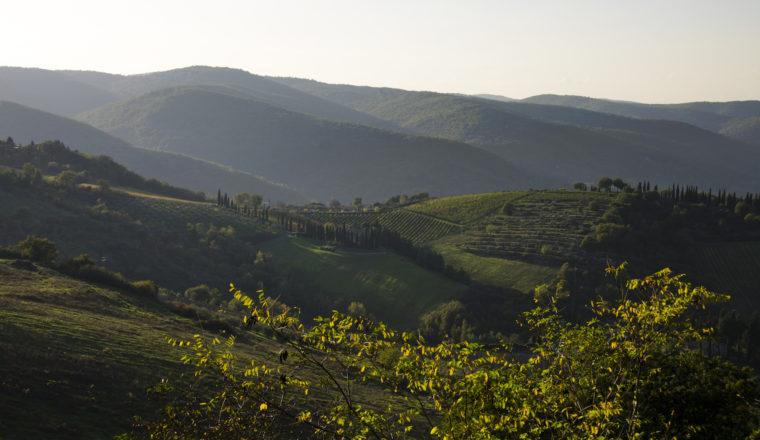
Day 34: San Gimignano –Monteriggioni … via Colle Val D’Elsa – 29 km
A fairly long day across lovely countryside – rolling hills, covered by the Chianti vineyards. Colle di Val d’Elsa is an interesting town where the art of blowing glass is still alive. The XI century San Salvatore church in Abbadia Isola is worth visiting while an ancient military post with its perfectly round walls is a unique sight.
Mixed itinerary mostly unpaved (80%) and paved secondary roads. Overnight in Monteriggioni or nearby.
Day 35: Monteriggioni – Siena – 17 km
Again a short segment to allow time in Siena. The route through pleasant countryside is unpaved almost all the way. Stay right in the centre of town a few minutes walk from the Piazza del Campo.
Day 36: Siena – Buonconvento – 32 km (reduced by included transfer at end of day from Ponte d’Arbia)
You will follow the official route for most of the day only to move slightly to the east toward the end in order to get away from the busy Via Cassia and spend the night in Vescovado di Murlo after visiting ancient Murlo, a lovely hamlet with a very interesting Etruscan museum.
Day 37: Buonconvento – San Quirico d’Orcia – 23 km
Generally easy terrain. The last third of the road is on secondary asphalt and follows the old Cassia. San Quirico was one of the most important stops on the way to Rome and has some of the most interesting buildings in the area with the Collegiata and the remains of an ancient pilgrims hospital.
Day 38: San Quirico – Castelnuovo dell’abbate – 13 km
The route from San Quirico is entirely unpaved and partly on trails. It offers beautiful views of the Ripa d’Orcia castle and of the Orcia gorge. The last stretch climbs steadily among the Brunello vineyards. You spend the night in Castelnuovo and will therefore have enough time to visit the abbey.
Day 39: San Antimo – Castiglione d’Orcia -19 km
There are trails which climb to the ridge overlooking the Orcia valley but – depending on the season – you may prefer the asphalt road as they are muddy and the “crete” mud is a sticky clay. The view is amazing. Castiglione is a nice village and if you feel up to the extra walk you can reach the Rocca Tentennano and the tiny charming hamlet below. Mixed itinerary secondary paved and unpaved.
Day 40: Castiglione d’Orcia – Radicofani – 27 km
You have the choice between a shorter route and a longer itinerary which passes by Bagni San Filippo, a very nice thermal spring where you can relax in a hot bath before facing the last climb to Radicofani, one of the most important stops on the Francigena. In the shade of its imposing Radicofani fortress it offers one of the most powerful landscapes of the whole route.
Mixed itinerary: trails, secondary paved and unpaved roads
Day 41: Radicofani –Acquapendente – 24.5 km
Partly unpaved to Ponte a Rigo, partly paved on secondary roads in a beautiful landscape. This high road overlooking the Cassia was the official way before the 16th century when the Bridge over the Paglia river was built.
Day 42: Aquapendente – Bolsena – 29.7 km
The main interest is the scenery, once you can see the lake. Stop to visit the Basilica del Santo Sepolcro as well as the the St Christina church in Bolsena.Itinerary: Mostly unpaved or paved on secondary roads and beautiful landscape with views of the lake.
Day 43: Bolsena – Montefiascone – 14 km
Bolsena is famous for the miracle of the sacred blood which is at the origin of the “Corpus Domini” celebration, and of the construction of the Orvieto Duomo.Possible detour: Civita di Bagnoregio, a spectacular ghost town perched on crumbling high cliff, a UNESCO protected site.Mostly unpaved or paved on secondary roads. A beautiful landscape with views of the lake. A large portion is original Francigena cobbled road.
Day 44: Montefiascone – Viterbo 17.8 km
Beautiful views across Bolsena lake, which, being of volcanic origins, is very deep. Near Viterbo you will pass Bagnaccio thermal pools where may like a soak in their milky-green steaming waters. Viterbo is a handsome small town, well off the normal tourist route. Walking is partly on secondary asphalt and partly on unpaved roads.
Day 45: Viterbo – Caprarola – 18 km
In the Middle Ages this route was taken to avoid unsafe, marshy areas on the plain where Malaria was a real risk. The present Cimini mountains route passes by volcanic Lake Vico and is a vast unspoiled area. Itinerary:mixed dirt and secondary asphalt.
Day 46: Caprarola – Sutri – 18 km
Again we disregard the official, crowded route in favour of an alternative mountain road. We walk on a ridge, discovering wide views on both sides. Itinerary: entirely dirt tracks on a ridge with beautiful views. Sutri is an unknown treasure, of Etruscan origins as indicated by the large necroplis just outside the town, its well preserved Roman Theatre is a reminder of conquest by the Romans.
Day 47: Sutri – Campagnano di Roma 18.5 km
The route from Martignano to La Storta can be completed in one day, but as it is long we have divided it into 2 parts. The route is a greeable and passes by the third volcanic lake of the area: Bracciano, popular with Romans who come for week-ends to escape Rome heat insummer. Mainly unpaved.
Day 48: Campagnano di Roma – Isola Farnese – 26.5 km
The notable sights of the day are the Madonna del Sorbo Sanctuary and the Etruscan archaeological site of Veio.
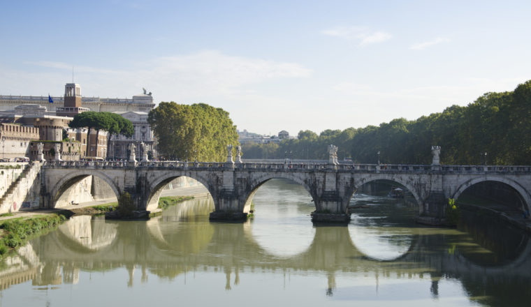
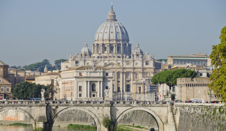
Day 49: Isola Farnese – Roma
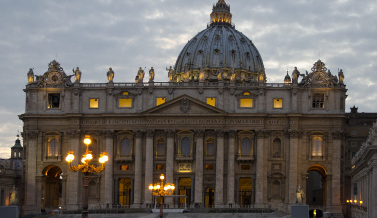
Walk the final day into Rome to arrive at San Pietro.
Day 50: Departure
Suggested Extras:
We can also arrange for extra nights or rest days along the route – please ask for details.
Accommodation is in a mixture of hotels, guesthouses, B&Bs and agritourismos (vineyard or farm stay) along the route.
Sample hotels:
San Miniato: Hotel San Miniato http://www.hotelsanminiato.com/en/
Gambassi Terme: Villa Certosa www.villadellacertosa.it
San Gimignano: Locanda Il Pino/ www.ristoranteilpino.it
Monteriggioni: Hotel Monteriggioni www.karenbrown.com/hotel/romantik-hotel-monteriggioni
Siena: Hotel Chiusarelli/www.chiusarelli.com
Buenconvento Hotel Ghibellino/www.ghibellino.it
San Querico:b&b L’Antica Sosta/ www.anticasosta.eu
Montefiascone: Hotel Urbano V/www.hotelurbanv.it
Viterbo: Hotel Minipalace
Capranola: B&B la Rocca/www.bblarocca.it
Sutri: Hotel Sutrium/www.sutriumhotel.it
Compagnano: Hotel Benigni /www.hotelbenigni.it
Isola Farnese: Tempio di Apollo- 3 stars/www.tempiodiapollo.com
Rome: Papavista relais/www.papavistarelais.com
We are happy to book additional nights along the route. Let us know where you would like rest days.
Breakfast is included each day. Unless you are staying in a hotel with a buffet style service, breakfasts are usually continental and these vary from a substantial meal with a lot of choice to a basic continental breakfast of just coffee or tea with juice, yogurt and bread or croissants.
For lunch it is usually possible to order packed lunches when there are no shops nearby. The route notes inform you when you need to take a packed lunch and this should be ordered the night before from your hosts.
Dinner can be included along the route – please ask if you wish to have this option. Cost is approx. £20 per night for dinner.